WFCOM Simuated Surface Currents and Sea Surface Height
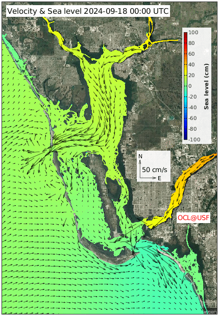
This movie shows the surface currents and sea surface height simulated by the WFCOM Nowcast/Forecast system in Charlotte Harbor region. It provides 1-day hindcast and a 3.5-day forecast. The above animation is also shown as an interactive movie.
Go back to whole West Florida Shelf coast page or view the sub-regions along the West Florida Shelf coast:
Disclaimer:
These research products are approximate model simulations under development. No warranty is made, expressed or implied, regarding accuracy, or regarding the suitability for any particular application. All rights reserved: University of South Florida, College of Marine Science - Ocean Circulation Lab. Copyright, 2023.