Navigation
DISCLAIMER:
The nowcast/forecast system and other analyses/data are research
products under development. No warranty is made, expressed or implied,
regarding accuracy, or regarding the suitability for any particular application. All rights reserved University of South Florida, Ocean Circulation Lab.
Copyright University of South Florida 2010
Observations
Drifter trajectories calculated from geostrophic currents
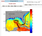
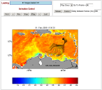
In this page you can see drifter trajectories over the Caribbean Sea and Gulf of America calculated from geostrophic surface currents. Sea Surface Anomaly (SSA) fields are taken from the E.U. Copernicus Marine Service Information, http://marine.copernicus.eu/). A HYCOM mean Sea Surface Height (SSH) is used to obtain absolute SSH, which is used to calculate the geostrophic currents. The trajectories are calculated using a Runge-Kutta second order scheme, and they are calculated each 6 hours. Here the drifter trajectories are superimposed on our OI SST product.Please choose:
| Drifters on the Gulf of America: |  |
| Drifters on the Caribbean Sea: |  |
Related information:
Katrina Tracking Tool page, developed in the wake of the Katrina Hurricane hitting the Gulf Coast. The outflow of the Mississippi River, with contaminated waters coming from New Orleans, was being taken rapidly to the Florida Keys, with important ecological consequences. The Katrina Tracking Tool helped to better understand and predict the fate of the Mississippi water.


