|
Tides on the West Florida Shelf
Ruoying He
and
Robert H. Weisberg*
College of Marine Science, University of South Florida 140 7th Ave. South, St. Petersburg, Florida 33701
Journal of Physical Oceanography Submitted October 2001 Revised February 2002
*Corresponding author: Tel: 1-727-553-1568, Fax: 1-727-553-1189 Email address: Weisberg@marine.usf.edu Abstract The principal semidiurnal (M2 and S2) and diurnal (K1 and O1) tidal constituents are described on the west Florida continental shelf (WFS) using a combination of in-situ measurements and a three-dimensional, primitive equation numerical model. The measurements are of sea level and currents spanning the coastline and the shelf width, respectively. The model extends from west of the Mississippi River to the Florida Keys with an open boundary arcing between. It is along this deep-water open boundary where the regional model is forced by a global tide model. Standard tidal analyses are performed for barotropic tides in both the data and the model and quantifiable metrics are provided for comparison. Based on these comparisons we present co-amplitude and co-phase charts for sea level and velocity hodograph ellipses for currents. The semi-diurnal constituents show marked spatial variability whereas the diurnal constituents are more spatially uniform. Apalachicola Bay is a demarcation point for the semi-diurnal tides that are well developed along the WFS to the southeast, but minimal to the west. The largest semi-diurnal tides are in the Florida Big Bend and Florida Bay regions with a relative minimum in between just to the south of Tampa Bay. These spatial distributions may be explained on the basis of local geometry. A Lagrangian Stokes drift, coherently directed toward the northwest, is identified, but of relatively small magnitude compared with the potential for particle transport by seasonal and synoptic scale forcing. Bottom stress-induced tidal mixing is examined and estimates are made of the bottom logarithmic layer height by the M2 tidal currents. 1. Introduction The Gulf of Mexico is a semi-enclosed basin connected to the Atlantic Ocean by the Florida Strait and to the Caribbean Sea by the Yucatan Channel. A notable feature of the Gulf of Mexico tides compared with many other places around the world is the dominance throughout the basin of the diurnal over the semi-diurnal constituents [Reid and Whitaker, 1981]. This is in contrast with the east coast of the United States, where the tides are predominantly semi-diurnal [Zetler and Hansen, 1971]. Previous Gulf of Mexico tides studies concluded that the diurnal tide is primarily co-oscillating, entering the Gulf of Mexico through the Florida Strait and existing through the Yucatan Channel. [Grace, 1932, 1933; Zetler and Hansen, 1971]. Located on the eastern side of the Gulf of Mexico, the west Florida continental shelf (WFS) is one of North America's broadest continental shelves. Apparently different from most of the Gulf of Mexico basin, semi-diurnal tides are appreciable here. Although this tidal structure was discussed in previous studies [Clark, 1991; Reid and Whitaker, 1981], descriptions of WFS tides are limited coastal sea level and a few regional current measurements. Koblinsky (1981) described the M2 tide over the southern portion of the WFS using velocity measurements from five moorings over a 2-year duration. The surface wave crests of the M2 tide, considered to be stationary, linear, and barotropic, were found to parallel the isobaths. Internal tides were not found and the temperature distribution was only slightly distorted by the surface wave. Marmorino (1983) added analyses of velocity data from four moorings deployed in the Florida Big Bend region. Semi-diurnal tidal constituent (M2 and S2) energy was found to decrease in the offshore direction, whereas the diurnal tidal constituent (K1 and O1) energy was more uniform across the shelf. As a result, the characterization of the tidal fluctuations changes from predominantly diurnal in deep water to semi-diurnal near the coast. Such spatial inhomogeneity exists throughout the WFS. Weisberg et al (1996) using velocity data from the 47 m isobath, showed that particle displacements in the semi-diurnal and diurnal bands are typically about 1 km. However, inertial oscillations, during months when the water column is stratified, can cause an increase in the diurnal band particle excursions to about 5 km. A deficiency of moored current meter data alone is that realistic arrays are insufficient to map the tides over the entire WFS. To do this we need a combination of in-situ data and a high resolution, area-encompassing model. The present paper combines recent in-situ measurements with a three-dimensional, primitive equation numerical model to describe and map the four major tidal constituents (M2, S2, K1, and O1) on the WFS and points farther west to the Mississippi River. We concentrate on the barotropic tides since the baroclinic tides are seasonally modulated and an order of magnitude smaller. Exceptions to the baroclinic motions being relatively small are the seasonally modulated inertial oscillations whose frequency overlaps with the diurnal tides. Baroclinic tides and inertial oscillations, whose effects on the deterministic barotropic tides are negligible [Clarke, 1991], will be the subject of a future correspondence. We begin in section 2 with the observations of coastal sea level and offshore currents, analyzing the barotropic tides by standard methods. Section 3 then introduces the regional model and discusses how it is driven at the open boundary by deep-ocean barotropic tides. The modeled tides and their comparisons with the in-situ data analyses for the M2, S2, K1, and O1 constituents are described in section 4. Based on these comparisons we provide maps of the principal constituent tidal ellipses over the entire domain using the model. We also use the model to estimate the Lagrangian transports induced by the barotropic tides and their attendant non-linear interactions. Since the amplitude of the tides determines their contribution to turbulence mixing, this is a discussion topic in section 5. The results are summarized in Section 6. 2. Observations The in-situ observations are taken from nine tide gauges operated by NOAA NOS and twelve current meter moorings deployed by the University of South Florida (Fig. 1). The nine tide gauges, referred to as South Pass, Waveland, Pensacola, Panama City, Apalachicola, Cedar Key, St. Petersburg, Naples, and Key West span the northeast Gulf of Mexico from the Mississippi river to the Florida Keys. The velocity data are from acoustic Doppler current profilers deployed across the WFS between the 300 m to 10 m isobaths. 2.1 Tidal Height The sea level data are analyzed using the least squares error method of Forman and Henry (1979). The analysis includes as many as 146 possible tidal constituents, 45 of these being astronomical in origin and the remaining 101 being shallow water constituents [e.g., Godin, 1972] that arise by distortions of the astronomical tidal constituents due to the non-linear effects of shoaling depth. Year-long time series of sea level are used for each of the eight sea level station analyses inclusive of the years 1996-1999. Data gaps preclude using the same year for all stations. Table 1 lists the amplitudes and phases (relative to the Greenwich meridian) for the M2, S2, K1 and O1 constituents, which in sum contain over 90% of the tidal variance. We note that the semi-diurnal tides to the south of are larger than those west of Apalachicola Bay. In contrast with the diurnal tides that have similar amplitudes at all nine stations, the semi-diurnal tides show large spatial variations. All of the four major constituents have amplitudes that peak near Cedar Key. To quantify the contribution that the tides make to the total sea level variance, a predicated tidal height time series, The ratios of the sub-tidal variability to the total sea level variability, 2.2 Tidal Currents
Parameters describing the tidal hodograph ellipses are calculated at each depth bin (0.5 m to 10 m depending on water depth) for each mooring. The amplitudes of the ellipse semi-major axis and the ellipse orientations (measured anti-clockwise from east) are shown as a function of depth in Figs. 2 and 3 for the four major constituents: M2, S2, O1 and K1. For a purely barotropic tide the amplitude and orientation would be independent of depth and appear as vertical lines. Depth profile deviations from straight lines are related to bottom friction, baroclinicity, and contamination by inertial motions, or combinations of these. As shown in Fig. 2 for relatively shallow depths and in Fig. 3 for relatively deeper depths, the semi-diurnal tides indeed appear to be barotropic, which agrees with the finding of Koblinsky (1981) for the WFS M2 tide. In contrast, the diurnal tides, especially in deeper water, tend to show vertical structure. This is most likely due to contamination by inertial motions since in the central WFS the inertial period is about 25.90 hrs which is close to the O1 and K1 periods of 25.82 hrs and 23.93 hrs, respectively. WFS inertial oscillations are modulated in time along with the seasonally varying stratification [Weisberg et al., 1996], and they are evident in velocity component plots as baroclinic modes consistent with the orientation reversals seen for the deeper records in Fig. 3. Overall, the observed tidal current amplitudes on the WFS are weak (on the order of a few cm s-1). Of the principle constituents, the M2 current is the strongest; its amplitude tends to increase shoreward, and its ellipse orientation tends to align perpendicular to the isobaths. While weaker, the diurnal constituent amplitudes are more uniformly distributed across the shelf, and these findings agree with the results of Marmorino (1983) for the tides of the Florida Big Bend region. 2.3 Phases of Tidal Height and Tidal Currents One question of interest (particularly for recreational fishermen) is the relative phase between the tidal height at the coast and the tidal current on the WFS. We address this question relative to the St. Petersburg tide gauge, the reference gauge for much of the WFS, in two different ways. Table 3a shows the phases (and corresponding time lags) between high tide at St. Petersburg and maximum tidal currents (directed toward the coast) at the 12 ADCP mooring sites for each of the major tidal constituents. For the semi-diurnal tides, the times of maximum tidal current generally lead the high tide at St. Petersburg by 2~9 hours. On the other hand, the maximum tidal currents of the diurnal tide, lag the high tide time at St. Petersburg by 10~20 hours. A second approach is to construct time series of the tidal height at St. Petersburg and tidal currents at the 12 ADCP sites by combining the four major tidal constituents, and then produce a set of lags for these composite time series. Table 3b gives these maximum correlation time lags between the water level h and the major component of tidal current u defined as where 3. Hydrodynamic Model Our work is preceded by several numerical model studies of Gulf of Mexico tides. Reid and Whitaker (1981) applied a finite difference version of the linearized Laplace tidal equations in a two-dimensional 15’ by 15’ (~ 28 km) horizontal grid to portray the barotropic response of the Gulf of Mexico to tidal forcing. While describing the deep-water tides well, their coarse grid size was insufficient to describe the tidal structures on the shelf. Westerink et al. (1993) applied a finite-element based hydrodynamic circulation model (ADCIRC-2DDI), also depth-integrated and two-dimensional, to the Western North Atlantic, the Gulf of Mexico, and the Caribbean Sea, to develop a tidal constituent database. Computations were presented for varying horizontal resolutions ranging from coarse (1.6 ° ´ 1.6 ° ) to fine (6’´ 6’), and discussion was given to the importance of model resolution. Their model comparisons with sea level data show good agreements in the Atlantic Ocean, but persistent errors occurred in the Gulf of Mexico and the Caribbean Sea. These authors suggested that insufficient resolution over the continental shelf, particularly in the shallowest regions, might be responsible for the relatively poor numerical convergence in those regions. More recently, Kantha et al. (http://www.ssc.erc.msstate.edu/Tides2D/) developed a data-assimilative, barotropic tidal model for the Gulf of Mexico with similar grid resolution as Reid and Whitaker (1981). Improved results follow from the assimilation of selected coastal tide gauge data. Nevertheless, this model has insufficient resolution to describe the structure of the tidal variations on the WFS. Our approach is therefore a regional one. The hydrodynamic model used is the Princeton Ocean Model (POM), a three-dimensional, nonlinear, primitive equation model with Boussinesq and hydrostatic approximations [Blumberg and Mellor, 1987]. The model uses an orthogonal curvilinear coordinate system in the horizontal and a sigma Water density is assumed homogeneous in this three-dimensional barotropic tide study. The three-dimensional distribution of the vertical eddy viscosity is computed using the Mellor and Yamada (1982) level 2.5 turbulence closure scheme, and the horizontal eddy viscosity is calculated using the shear-dependent Smagorinsky formulation [Smagorinsky, 1963] with a coefficient of 0.2. Dissipation by vertical friction is found to largely exceed that by horizontal friction. The bathymetry adopted in the model begins with the ETOPO5 5’x5’ global bathymetry data set. Since this data set is inaccurate in the southern portion of WFS we corrected it by incorporating data from NOAA navigation charts and NGDC bathymetry contours. Our modified bathymetry has been used in other WFS modeling studies with satisfactory results (e.g., He and Weisberg, 2002; Weisberg et al, 2001; Yang et al, 1999). Tidal forcing of the model is exclusively at the open boundary. There, the tidal elevations are specified by a linear interpolation of the output from the TOPEX/Poseidon data assimilated global tidal model of Tierney et al. (2000). This barotropic model, with 15' resolution, provides eight tidal constituents (M2, S2, N2, K2, K1, O1, P1 and Q1) over a nearly global domain that extends from 80° S to 66° N. The model assimilates both coastal tide gauge data and ocean tides derived from four years of TOPEX/POSEIDON satellite altimetry data. Since it uses procedures that tend to preserve the spatial tidal structures in shallow water, it is considered to be a suitable product for forcing higher resolution regional tidal models. Figure 5 shows the distributions of tidal amplitudes and phases for M2, S2, K1 and O1 constituents along the open boundary where we have a total of 121 model grids.
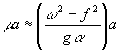
4. Modeled Elevations and Currents 4.1 General features The model is forced at the open boundary by specifying the composite M2, S2, K1, and O1 constituent elevations there. Elevations, currents, and turbulence quantities are computed over the model interior by integrating forward in time beginning from a state of rest. An initial spin-up period of five inertial cycles (about five days) is used to suppress transients. The subsequent 30 days are then analyzed using the same techniques as for the in-situ data to retrieve individual constituent amplitude and phase distributions over the model domain. Table 1 provides detailed amplitude and phase comparisons between the modeled and observed elevations of M2, S2, K1, and O1 at the nine coastal tide gauge stations spanning the analysis domain. Amplitude differences are generally less than 2 cm; the singular exception being at Cedar Key where it is 2.5 cm for M2. Phase differences are less than 10° ; with Naples at 10.1° for O1 being the largest. Both the amplitude and phase differences show equally likely plus or minus values demonstrating that the modeled tides are not biased. Root mean square (rms) values of the phase differences, when converted to time, amount to less than 10 min (20 min) for the semi-diurnal (diurnal species). Considering the model tide gauge sampling relative to the actual tide gauge positions and the near-shore masking (2 m being the shallowest model depth), these phase agreements are both good and as good as can be expected. Therefore, no model tuning was considered. The along-coast variations of the amplitudes and phases of the four major tidal constituents are graphically shown in Fig. 6, where circles denote the observations and crosses indicate the model results. Allowing for scale changes in the abscissa we see a relative spatial homogeneity in the diurnal species compared with a more spatial inhomogeneous distribution for the semi-diurnal species. We also note several bulls-eyes in the model-observation comparison. The agreements of Table 1 and Fig. 6 justify using the model to produce co-amplitude and co-phase charts for the M2, S2, O1, and K1 constituents (Fig. 7). In general agreement with the findings of the previously cited Gulf of Mexico tide studies, these maps provide further details of the tidal structures on the WFS. The semi-diurnal and diurnal species are distinctly different. The phase of the M2 tide advances toward the northwest. Apalachicola Bay separates the M2 tidal regime into two parts. To the west the M2 tide is weak. To the east it is strong. Both the Florida Big Bend and the Florida Bay regions show relative maxima with a relative minimum in between just to the south of Tampa Bay. The S2 constituent shows features similar to the M2 constituent, but with a much smaller amplitude. The phase patterns for the semi-diurnal species appear to result by diffraction around the Florida Keys and onto Cape San Blas. Amplification of the semi-diurnal tides in the Florida Big Bend has been discussed by previous investigators. Reid and Whitaker (1981) considered a resonance deriving from the counterclockwise speed of propagation matching the group speed for a gravest mode edge wave ( Local geometry may also induce amplification. The isobath (Fig. 1) and the co-amplitude plots for the semi-diurnal tides (Fig. 7) show similarity. Where the shelf is narrow the amplitudes are small, and conversely. The two regions of widest shelf are the Florida Big Bend and the Florida Bay with a relative minimum in between, as reflected in the co-amplitude distributions. Effects of local geometry are considered in the analytical treatments of Battisti and Clarke (1982 a,b) and Clarke (1991). For a continental shelf with an along-shore scale much greater than the shelf width these authors developed a one dimensional tide model to explain some of the observed barotropic tidal characteristics. Using a linearized bottom stress (ru/h), the linear Laplace tidal equations are
For tidal motions over a continental shelf with constant slope a and width a, i.e.,
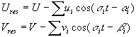
For the semi-diurnal tide ( Unlike the semi-diurnal tides, the diurnal tides show little co-amplitude variations across the analysis domain. Both the amplitudes and phases for the O1 and K1 constituents are nearly spatially uniform. This is consistent with the Zetler and Hansen (1971) finding that the diurnal tide is essentially in phase throughout the Gulf of Mexico. It is also consistent with equation 4 (Clarke, 1991), since for The ratio between the amplitudes of the principal semi-diurnal and diurnal tide constituents, (M2+S2)/(K1+O1), is shown in Fig. 8. While the WFS tidal regime is generally characterized as mixed and mainly of diurnal type, this is not true of the inner half of the WFS where the ratio exceeds 0.5 and especially of the Florida Big Bend and Florida Bay regions where the semi-diurnal tides dominate. It is only over the outer portion of the WFS and to the west of Apalachicola Bay where the diurnal species dominate. Given the model sea level descriptions and the model and in-situ data agreements for sea level at the coast, we now examine the tidal currents in a similar manner. Fig. 9 compares the depth-averaged tidal current hodographs (calculated from all of the in-situ data locations of Fig. 1) with the depth-averaged tidal current hodographs calculated from the model sampled at all of these in-situ data sites. Qualitatively, the comparisons are very good for the semi-diurnal constituents, with ellipse semi-major amplitudes, eccentricities, and orientations all in agreement (see Table 4 for listings of the hodograph ellipse semi-major axes, semi-minor axes, and orientations). Particularly notable is how the ellipse orientations diverge away from the region of relative minimum semi-diurnal tide elevation just south of Tampa Bay. Eccentricities at the stations closed to the coast show the largest departures between the data and the model, which may be a consequence of the model turbulence parameterization. Deviations from an inviscid fluid semi-minor to semi-major axis ratio of wf -1 are due to the friction, which is consistent with the largest departures being in the shallowest water. Nevertheless, the agreements are still very good. The overall agreements between the observed and modeled diurnal constituents, while also good, are degraded somewhat from those of their semi-diurnal brethren, and there are additional reasons for this behavior. As pointed out by Reid and Whitaker (1981), modeled currents are more sensitive to factors such as bottom friction, horizontal eddy diffusivity, and topography than are modeled water levels. A particular problem in the Gulf of Mexico for diurnal constituents is the closeness in frequency between these and the local inertial period. Large inertial oscillations exist in the WFS observations when the water column is stratified. While not a subject of this paper, we did investigate several different techniques in attempting to minimize inertial oscillation interference in the data. For instance, we broke the data records into month-long pieces to distinguish barotropic tides during months without stratification versus mixed barotropic tides and inertial oscillations during months with stratification. Non-uniform modulation made this too subjective, however. Recognizing that the inertial oscillations when present are predominantly of first baroclinic mode structure we opted to perform the data analyses on depth averaged currents, effectively averaging out the inertial oscillations. Nevertheless, some non-tidal inertial oscillatory behavior may still be contaminating the diurnal constituent hodographs of Fig. 9. Similar problems do not exist for the semi-diurnal constituents since they are removed in frequency from the inertial oscillations. Small baroclinic amplification is observed in the data during months when the WFS is stratified, but these are effectively removed in the process of depth averaging. Whether such amplification with stratification is the result of internal tide generation or a reduction in the effects of bottom friction by the stratification remains to be determined. The agreements between the observed and modeled tidal current ellipses are sufficiently good to warrant the mapping of these ellipses over the entire model domain. These are shown in Fig. 10 for the M2, S2, O1, and K1 constituents. The general patterns seen in the co-amplitude contours are reflected here. M2 currents amplify from very small values in deep water to largest values (approaching 20 cm s-1) near-shore in the Florida Big Bend and Florida Bay. The relative minimum in between to the south of Tampa Bay is evident with the hodograph orientations diverging away from this point. To the west of Apalachicola Bay we see very little M2 tidal current except just to the east of the Mississippi River where the shelf again widens away from the DeSoto Canyon. The S2 tidal currents behave very similarly to the M2 tidal current except that they are weaker. The O1, and K1 ellipses appear very similar to one another, being weaker than the M2 and stronger than the S2 ellipses over the WFS, but stronger than either of these to the west of Apalachicola Bay. Eccentricities in general agree with the tendencies from inviscid theory that the tidal ellipses should be more circular (w f–1) for the diurnal species than for the semi-diurnal species, and the polarizations are clockwise. 4.2 Tidal Residual Current and the Lagrangian Transport The model, being a fully non-linear, is capable of generating responses in addition to the four linear tidal harmonics with which it is forced. Here we investigate these tidal residual currents (Ures, Vres) defined as the difference between the model responses (U, V) and the four constituent tidal harmonic currents analyzed from the model output. Thus, the Eulerian residual current is calculated as: where (ui , vi) and (a i , b i ) are the analyzed harmonic constants for the M2, S2, K1 and O1 tidal constituents. Figure 11 presents the residual currents in both Eulerian and Lagrangian frameworks. The Eulerian representation (upper panel) is the residual surface current field after subtracting from each grid point the linear least squares fit of the four major tidal constituents. The Eulerian residual field is weak (generally less than 0.01m s-1) and generally directed toward the north or northwest consistent with the propagation direction for the semi-diurnal tides. Vectors appear largest in the Florida Big Bend where they also form an anticyclonic gyre. The Lagrangian representation (lower panel) is calculated by tracking surface drifters originating at every fourth grid point over a 30-day period, i.e., they are Lagrangian trajectories for dynamically passive particles released at the surface on day 6 (after the five day spin-up period) and tracked through day 35. The patterns appear very similar to the Eulerian representation. Particle displacements are small (order 10 km per month) suggesting that barotropic tidal current rectification is not a mechanism of major importance in transporting materials on the WFS. 5. Bottom Stress and Turbulence Mixing Turbulence mixing in this POM-based barotropic tide model derives from bottom stress calculated using a quadratic drag law. Here we examine the bottom stress distribution, its mixing ramifications for the water column, and the implications of these findings for simpler models that employ a linear drag law. For simplicity, only the M2 current is considered since it is the dominant contributor to the WFS tidal currents. Bottom stress, for either depth-dependent or depth-averaged models, may be defined in several different ways, such as: where r
is the water density and for the first two (depth-dependent) cases u* is the friction velocity, CD is a bottom drag coefficient, and u is the near-bottom current. For the third (depth-averaged) case Since bottom stress is calculated by a quadratic drag law it is of interest to check the sensitivity of our results to the bottom drag coefficient CD. The only adjustable parameter in is the bottom roughness length z0. Our default value is 0.01 m. For sensitivity studies we varied z0 between 0.002 m - 0.05 m and found no significant differences. The explanation is in the parameterization that uses the maximum value of either 0.0025 or that determined by z0. Given our vertical resolution the only place where z0 affects CD is in very shallow water. Beyond a certain depth (that includes about 95% of our model domain) CD equals the POM default value of 0.0025. For the case of linear, depth-averaged models bottom stress is set by the resistance coefficient r. As examples, Clarke (1991) used r=2´ 10-4 ms-1, whereas Lentz et al (2001) found r=5´ 10-4 ms-1 to be appropriate for the North Carolina shelf. Using rms bottom stress and depth-averaged current distributions we arrive at r estimations here (equation 6) that range across the shelf from 0.6 ~ 6´ 10-4 m s-1 (middle panel of Fig. 12). Thus, the use of constant values for r, while appealing for linear model calculations, may either overestimate or underestimate the bottom stress on continental shelves. Value judgements about quadratic versus linear drag laws, aside, we simply emphasize that bottom friction parameterization for models remains a complex, empirical issue. Boundary layer theory identifies different layers [e.g., Soulsby, 1987], each with different behaviors. The "bed layer" immediately adjacent to the bottom is where molecular viscosity n controls the dynamics. Within this layer (of a few centimeters thickness) we have Above the bed layer is the "logarithmic layer" within which neither the details of the bed nor the free-stream flow affect the local dynamics, and for which the velocity profile follows the universal form,
where k » 0.4 is the von Karman constant.
noting that A>>n where the constant stress and logarithmic regions overlap, and using equations (8) and (10), we arrive at By similarity we can use this specification for A to estimate the Ekman layer thickness, d , for steady state flow regimes, i.e., where f is the local Coriolis parameter and c=0.1 ~0.4 [e.g., Loder and Greenberg, 1986, Weatherly and Martin, 1978].
and assuming For the case of the M2 tide-induced bottom boundary layer on the WFS, with s
M2 »
2f, the bottom boundary layer thickness may be estimated as The height of the logarithmic layer is taken as some fraction of the Ekman depth. Soulsby (1987), for instance, defines the logarithmic layer height as 0.1d and with this definition the lower panel of Fig. 12 shows the M2 tidal current-induced logarithmic layer height for the WFS. Values are generally less than 1 m. Empirical determinations of the log layer based on the in-situ bottom boundary layer measurement on the WFS are presently in progress and these will be reported on separately.
6. Summary Using in-situ data and a numerical circulation model we examine the structure of the WFS tides and the effects of the tides in distributing water properties and in mixing the water column vertically. Attention is limited to barotropic tides and to the four major tidal constituents (M2, S2, O1 and K1) that account for the bulk of the tidal variance (~ 90%) of the region. The data are from coastal sea level stations ranging from the Mississippi River delta to the Florida Keys, and from current meter moorings deployed across the shelf between the 10 m to 300 m isobaths. The model is a regional adaptation of the POM extending from west of the Mississippi River to the Florida Keys with a single open boundary arcing between these land termini. Regional tides are produced by forcing the model at its open boundary using the composite M2, S2, O1, and K1 sea level variability from the global (TOPEX/Poseidon assimilated) tide model of Tierney et al. (2000). With standard tidal analysis tools, we produce co-amplitude and co-phase maps for each constituent and compare both sea level and currents against actual observations. Based on the fidelity of comparison we then use the model products to discuss the WFS barotropic tides. Apalachicola Bay, in the Florida Panhandle, is a dividing point between appreciable semi-diurnal tides to the east over the WFS and minimal semi-diurnal tides from there to the Mississippi River delta. In contrast with the semi-diurnal tides, the diurnal tides are spatially more uniform. With respect to overall rms sea level variability, tides account for about 30% west of, versus about 50% southeast of Apalachicola Bay, respectively. The balance of the rms variability is due to synoptic scale weather-induced sea level change. Co-amplitude maps show largest tides in the regions where the shelf is widest, i.e., in the Florida Big Bend and in Florida Bay. The region just south of Tampa Bay shows a relative minimum. Both the amplification of the semi-diurnal constituents and the spatial variations with shelf width are consistent with linear theory [e.g. Clarke, 1991 and Lentz, 2001]. Such theory also accounts for the relative spatial uniformity of the diurnal constituents. We conclude that the spatial distributions of the tides on the WFS are the result of local geometry, as contrasted with previous ideas about basin-wide tidal resonance. The tidal currents on the WFS, especially the semi-diurnal constituents, are primarily barotropic. Very good agreements are obtained between the in-situ data derived and the modeled tidal hodograph ellipses. Semi-major axes are generally less than 0.1 m s-1, and the ellipses are generally oriented normal to the shoreline. Ellipse orientation, however, does reflect the co-amplitude distributions with tidal currents tending to diverge (converge) on regions of relative minima (maxima). A relatively small seasonal modulation is observed in the semi-diurnal tidal currents due to either internal tides or reductions in friction by stratification. Larger seasonal modulation is observed in the diurnal constituents due to the generation of inertial oscillations under stratified conditions. Inertial oscillations, when present, are generally organized as first baroclinic modes so they tend to cancel out when performing vertical averages. This helps to facilitate the barotropic tidal analyses. Baroclinic tides and inertial oscillations will be reported on separately. The non-linearity of the model allows it to generate mean currents despite its linear harmonic forcing. We present these residual currents in both Eulerian and Lagrangian frameworks to assess their potential effects on tidal residual material transports. While a coherent Stokes-drift pattern toward the northwest emerges, the magnitudes are small (one to two orders of magnitude less than the semi-major axis speeds) amounting to net particle trajectories of generally less than 10 km per month. Albeit persistent, this is smaller than the potential particle trajectories for either seasonal or synoptic scale forcing [e.g., Weisberg et al., 1996]. With the M2 tide having the largest tidal current magnitude we use this constituent to examine the spatial distribution of bottom stress by tides on the WFS and the role that this may play in water column mixing. Except for the shallow regions of the Florida Big Bend and Florida Bay, the potential for mixing by tides is weak. Attempting to parameterize friction in a linear model using a resistance coefficient is limited by the spatial variability in bottom stress; nevertheless, the values estimated are within the range of values used in other studies. Estimates of logarithmic layer thickness by the M2 tide are generally less than 1 m and empirical studies are under way to quantify this better. In closing, with quantifiable metrics we show that regional tides on the WFS may be adequately described by forcing a regional, primitive equation, three-dimensional model with a global tide model at the open boundary, and that the properties of the tidal variations result primarily from the local geometry. Acknowledgements. The in-situ data collection and numerical model developments benefited from several sponsors. The measurements were initiated under a cooperative agreement between the US Geological Survey, Center for Coastal Geology and the USF College of Marine Science. Subsequent support by the Minerals Management Service, cooperative agreement # 14-35-0001-30787 is noted. Our work continues under support by the Office of Naval Research, grant # N00014-98-1-0158 and the National Oceanic and Atmospheric Administration, grant # NA76RG0463. Special thanks are offered to the family of Elsie and William Knight for the research fellowship endowment that helped to support R. He. Messrs. R. Cole, J. Donovan, and C. Merz are largely responsible for the success of the field program. Dr. S. Meyers contributed analyses and discussions, and we are particularly grateful for the helpful e-mail discussions provided by Prof. Robert Reid.
References Battisti, D.S. and A. J. Clarke, 1982a, A simple method for estimating barotropic tidal Battisti, D. S. and A. J. Clarke, 1982b, Estimation of nearshore tidal currents on Blumberg, A. F., and G. L. Mellor, A description of a three-dimensional coastal ocean Clarke, A. J. 1991, The dynamics of barotropic tides over the continental shelf and slope Foreman, M.G.G., 1978, Manual for tidal currents analysis and prediction. Pacific Forman, M.G.G., Henry, R. F., 1979, Tidal analysis based on high and low water Godin, G., 1972, The analysis of tides, University of Toronto Press, Toronto, Ont. Grace, S.F., 1932, The principle diurnal constituent of tidal motion in the Gulf of Mexico. He, R. and R. H. Weisberg, 2002, West Florida shelf circulation and temperature budget for the Kajiura, Kinjiro. 1958, Effect of Coriolis force on edge waves (II) specific examples of Koblinsky, C. J. 1981, The M2 tide on the West Florida Shelf. Deep Sea Res. Vol. 28A, Loder, J. W. and D. A. Greenberg, Predicted positions of tidal fronts in the Gulf of Maine Marmorino, G. O. 1983, Variability of current, temperature, and bottom pressure across Mellor, G. L., and T. Yamada, Development of a turbulence closure model for Reid. R. O. and R.E. Whitaker, Numerical model for astronomical tides in the Gulf of Smagorinsky,J., General circulation experiments with primitive equations. I. The basic Soulsby, R. L. The bottom boundary layer of shelf seas. In Physical Oceanography of Tierney, C.C, L.H. Kantha and G.H. Born, 2000, Shallow and deep water global ocean Weatherly, G. L. and P. Martin, 1978, On the structure and dynamics of the oceanic Weisberg, R.H. B. D. Black, H. Yang, 1996, Seasonal modulation of the West Florida Weisberg, R. H. and Z. Li and F. Muller-Karger, 2002, West Florida shelf response to local wind Westerink, J, J, R. A. Luettich, N. Scheffner, 1993, ADCIRC: an advanced three- Yang, H, R. H. Weisberg, P. P. Niiler, W. Sturges, W. Johnson, Lagrangian circulation Zetlzer, B. D. and D. V. Hansen, 1971, Tides in the Gulf of Mexico. In: Contributions on
List of Tables Table 1. Comparisons of observed and computed tidal elevations at reference sites. Table 2. Normalized rms tidal residuals showing the contributions of non-tidal fluctuations to the sea level variability at the nine tide gauges spanning the study domain. Table 3a. Greenwich phases of the major tidal constituents at the St. Petersburg tide gauge and at the 12 ADCP stations (left hand columns), plus the relative times between high water at St. Petersburg and maximum (shoreward directed) semi-major axis tidal currents at the 12 ADCP stations (right hand columns). Phase differences are converted to time differences using speeds of M2, S2, O1 and K1 of 29.98 deg/hr, 30.00 deg/hr, 13.94 deg/hr and 15.04 deg/hr, respectively, where "+" and "-" indicate time lags and leads, respectively. Table 3b. The time lags between high tide at St. Petersburg and the maximum (shoreward directed) semi-major axis tidal currents at the 12 ADCP stations determined by the maximum lag-correlation coefficient between the composites of the M2, S2, O1, and K1 constituents Table 4. A comparison between observed and modeled tidal ellipse parameters. List of Figures Figure 1. Model domain and observational locations. The nine tide gauges (denoted by stars) are: South Pass, Waveland, Pensacola, Panama City, Apalachicola, Cedar Key, St. Petersburg, Naples, and Key West. The 12 moorings for velocity data (denoted by triangles) are: AS1 (47m), TS1 (31m), TS2 (47m), TS3 (46m), TS4 (63m), TS5 (142m), TS6 (296m), EC2 (50m), EC3 (30m), EC4 (20m), EC5 (10 m), and EC6 (10m). Figure 2. Vertical profiles of the velocity hodograph ellipses semi-major axis amplitudes and orientations (measured anti-clockwise from east) for the EC designated moorings. The thick solid and dashed lines denote M2 and S2, respectively. The thin solid and dashed lines denote O1 and K1, respectively. Figure 3. Vertical profiles of the velocity hodograph ellipses semi-major axis amplitudes and orientations (measured anti-clockwise from east) for the TS designated moorings. The thick solid and dashed lines denote M2 and S2, respectively. The thin solid and dashed lines denote O1 and K1, respectively. Figure 4. The model grid used for the regional tidal simulation. Figure 5. The distributions of tidal amplitudes (upper panel) and phases (lower panel) along the model open boundary for the M2, S2, K1, and O1 constituents (see legend provided). The abscissa is the grid index that includes both points over land and water. The land points are masked so only the points over water are shown. Figure 6. Comparisons between modeled and observed amplitudes (left panels) and Greenwich phases (right panels) for the M2, S2, K1, and O1 constituents at the nine coastal tide gauge locations. Crosses (circles) denote modeled (observed) values. Bulls eyes are where they overlay. Figure 7. Modeled co-amplitude and co-phase (relative to the Greenwich meridian) distributions for the M2, S2, O1, and K1 tidal constituents. Solid (dashed) lines denote amplitudes (phases), and the contour intervals are indicated in the lower left corner of each panel. Figure 8. The amplitude ratio between the principle semi-diurnal and diurnal tides. Figure 9. A comparison between the observed (left panels) and modeled (right panels) M2, S2, O1, and K1 tidal current hodograph ellipses at the 12 moored ADCP locations. Figure 10. The distributions over the entire model domain of the modeled M2, S2, O1, and K1 tidal current hodograph ellipses. Figure 11. Eulerian (upper panel) and Lagrangian (lower panel) representations of the tidal residual surface circulation. Figure 12. The spatial distribution of mixing properties inferred from the M2 tidal currents. From the top to bottom are the friction velocity (u*), the resistance coefficient (r), and the log-layer thickness. Units are provided in each panel, as are bathymetric contours (light lines) for the 20 m, 50 m, 100 m, 200 m, 1000 m and 2000 m isobaths. Table 1. Comparison of observed and computed tidal elevation at reference sites.
Table 2. Normalized rms tidal residuals showing the contributions of non-tidal fluctuations to the sea level variability at the nine tide gauges spanning the study domain.
Table 3a. Greenwich phases of the major tidal constituents at the St. Petersburg tide gauge and at the 12 ADCP stations (left hand columns), plus the relative times between high water at St. Petersburg and maximum (shoreward directed) semi-major axis tidal currents at the 12 ADCP stations (right hand columns). Phase differences are converted to time differences using speeds of M2, S2, O1 and K1 of 29.98 deg/hr, 30.00 deg/hr, 13.94 deg/hr and 15.04 deg/hr, respectively, where "+" and "-" indicate time lags and leads, respectively.
Table 3b. The time lags between high tide at St. Petersburg and the maximum (shoreward directed) semi-major axis tidal currents at the 12 ADCP stations determined by the maximum lag-correlation coefficient between the composites of the M2, S2, O1, and K1 constituents
Table 4. A comparison of computed and observed tidal ellipses parameters
|
 (4)
(4) (5)
(5)